Good afternoon everyone and Happy Saturday! I hope your weekend is going well. Attached are the First Predictions for Tuesday, February 13 and Wednesday, February 14, 2024.
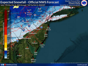
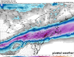
An area of low pressure is expected to pass by the region overnight Monday night through Tueseday. The current expectation is for rain to start out initially but quickly convert to snow before dawn on Tuesday and continue through daylight hours. Model guidance has been very inconsistent on where the heaviest axis of snowfall will occur. If the axis is north of our area, then temperatures will struggle to fall below freezing sooner and therefore cut into snow accumulations. On the other hand, if the heaviest axis is to the south of the area, then dry air starts to become a limiting factor. Below are examples of different model guidance outputs for this system: you can see how widespread the heaviest snowfall location varies by model. The National Weather Service forecast is shown first, but it only shows snowfall through 7 AM Tuesday, so it does not caputre all of the snowfall for this system.
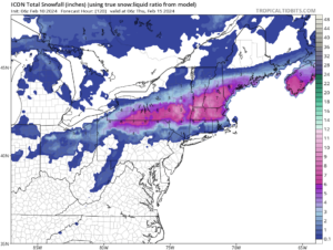
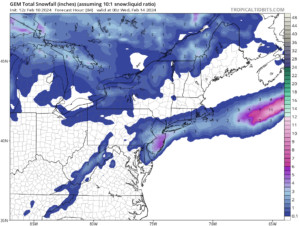
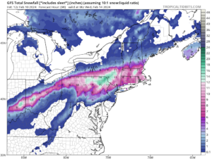
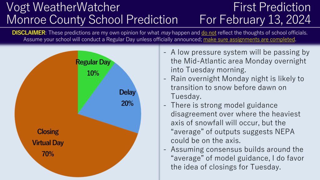
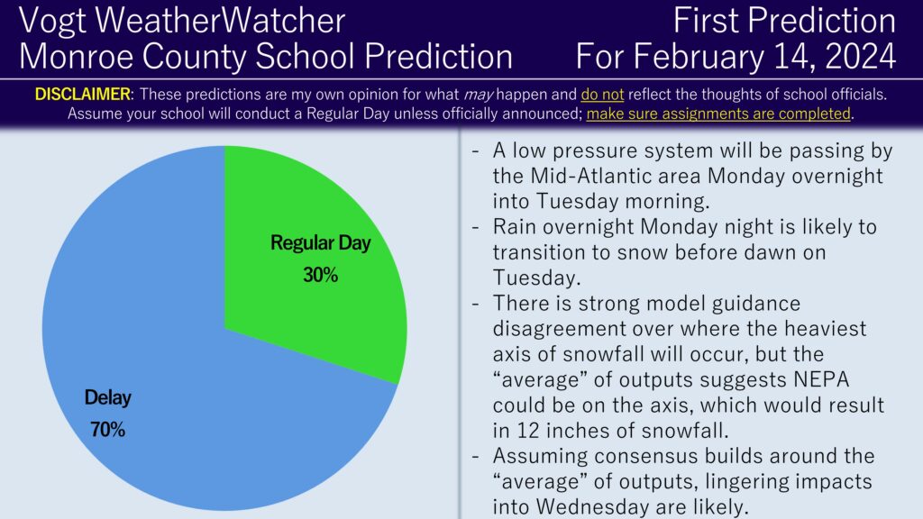
When considering the average of these results and when examining ensemble guidance, it does place the area of heaviest snowfall in or near the Poconos. Therefore, I do believe the area is poised to receive at least 6 inches of snowfall on Tuesday and possibly up to 12 if the stars align. I do believe closings are a likely outcome for the county on Tuesday; since schools tend to delay the following day of impactful snow events, I also believe delays are likely on Wednesday. Keep in mind this is still subject to change; consensus should build over the next 24 to 36 hours and the predictions will adjust as necessary to the consensus.
I plan on issuing the Second Predictions for Tuesday and Wednesday tomorrow evening. Have a great day everyone and thank you for the support!