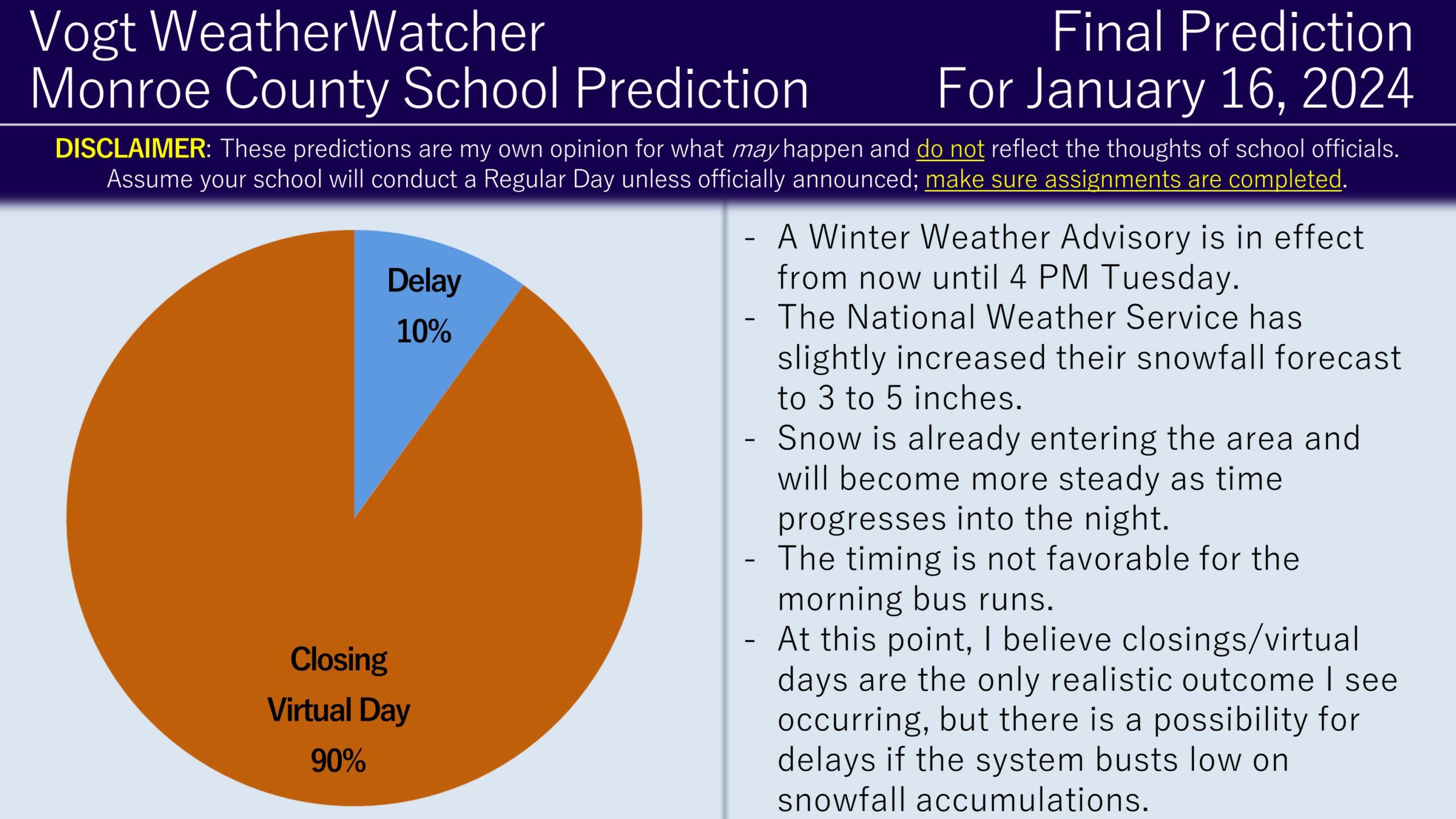
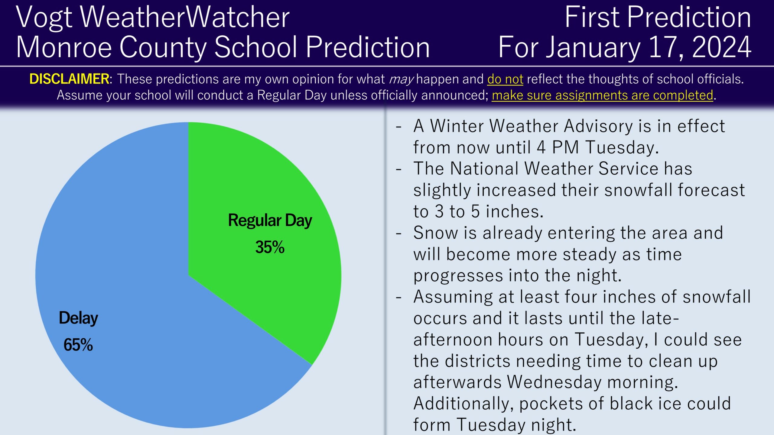
Good evening everyone and Happy Monday! Attached is the FINAL Prediction for Tuesday and the First Prediction for Wednesday.
A Winter Weather Advisory is in effect from now until 4 PM Tuesday. The National Weather Service is anticipating 3 to 5 inches of snowfall; this is slightly higher than the previous forecast. Snow is approaching the region and will become more steady as the evening progresses.

The timing is not looking favorable at all for the morning bus runs on Tuesday morning. I am highly suspicious a delay is not going to result in much benefit. Therefore, I am favoring the closing scenario for all districts within the county, with a small chance for a delay if snow totals end up much lower than expected.

Then the question becomes will there be any lingering impacts into Wednesday and I believe the answer is yes. Assuming at least four inches of snowfall occurs and it lasts until the late-afternoon/early-evening hours on Tuesday, then I think school districts will need the extra time in the morning to clean up schools and prepare buses. Additionally, there is the natural concern for black ice to develop underneath the snow, creating slick spots Wednesday morning. Typically, school districts delay the following day of a impactful snow event for these reasons and I believe that will generally be the case for Wednesday. There is the possibility for districts to remain on time on Wednesday, particularly if lower than expected snowfall occurs.
I plan on issuing the Second Prediction for Wednesday tomorrow morning. I do anticipate school districts to most make closing calls tonight. At the time of this writing, some districts have announced delays for tomorrow, but I suspect they will re-evaluate to closings (not a guarantee!). Have a great evening everyone and thank you for the support!
Curious about getting hourly school predictions for your local county four days in advance? Check out the Premium Site! It covers 12 counties throughout Northeastern Pennsylvania, including the areas of Scranton, the Poconos, and the Lehigh Valley. It also includes precipitation and temperature forecasts, power outage projections, long range school risks (out to 6 days in advance), and commute impacts. It is also a great way to support the service. Check it out!
