Good afternoon everyone! I hope you enjoyed waking up to a winter wonderland this morning. With the latest weather forecast and based on how much snow fell, there is the potential for school reactions on Monday, Tuesday, and Wednesday! We have a quite a bit to get through, so let’s jump in!
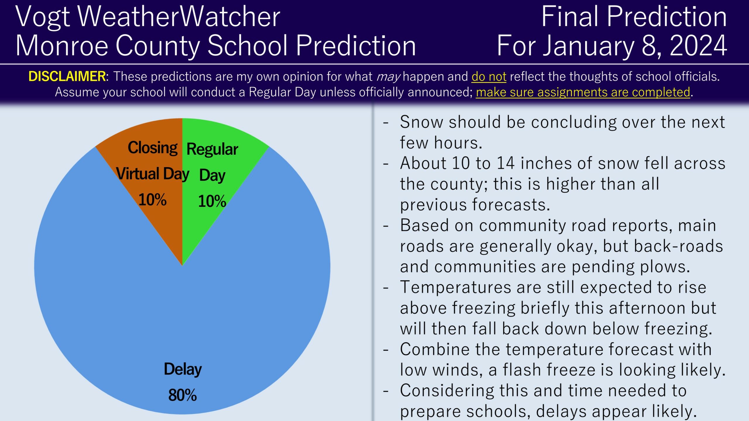
10 to 14 inches of snowfall has been observed throughout the region (thanks everyone for the snow and road reports!). This is higher than any National Weather Service forecast leading up to the event. Snow should be wrapping up over the next few hours; temperatures will be rising above freezing for a period this afternoon, but will then fall back down below freezing this evening and into the overnight. Winds will remain relatively light; with temperatures falling to the mid 20s, I am anticipating black ice to form. Therefore, I am anticipating delays for tomorrow. I cannot rule out the possibility for a Regular Day (for areas that received less snow) and I cannot rule out the possibility of closings and virtual days (if black ice is severe and widespread in the morning). Therefore, the FINAL Prediction is as follows…

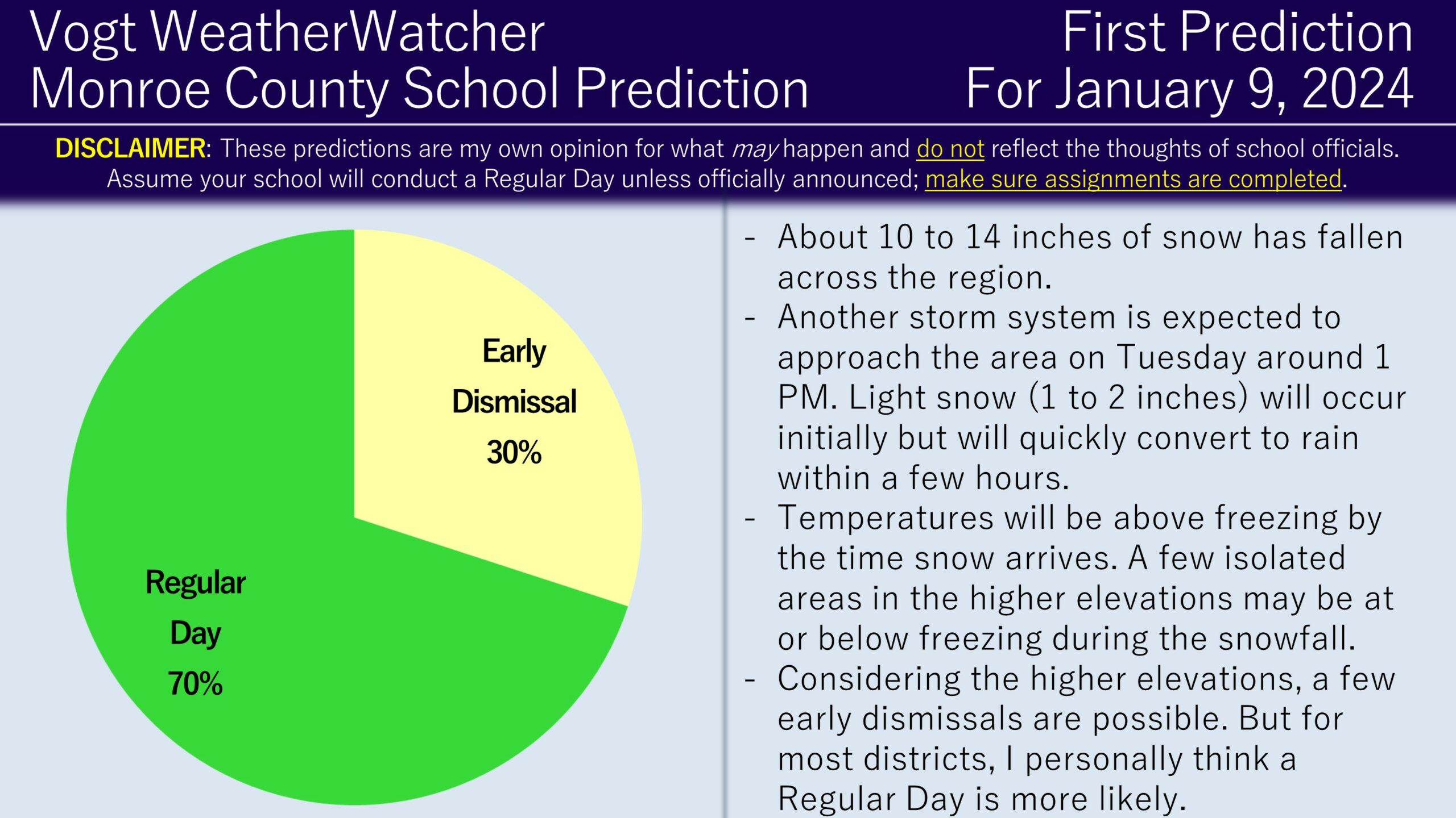
As we look to Tuesday, another storm system will be approaching the area, but this time, much less snowfall is expected. Around 1 PM Tuesday, light snow (1 to 2 inches at most) is expected to occur initially, then will cover over to rain within a few hours of starting. Temperatures for most of the county will be above freezing, but higher-elevated areas are expected to be below freezing during the snowfall. Temperatures will rise much above freezing as the evening progresses due to the warm front associated with the system. As a result, I do anticipate most schools to remain on time; but for the elevated areas, I think there is a risk for early dismissals.

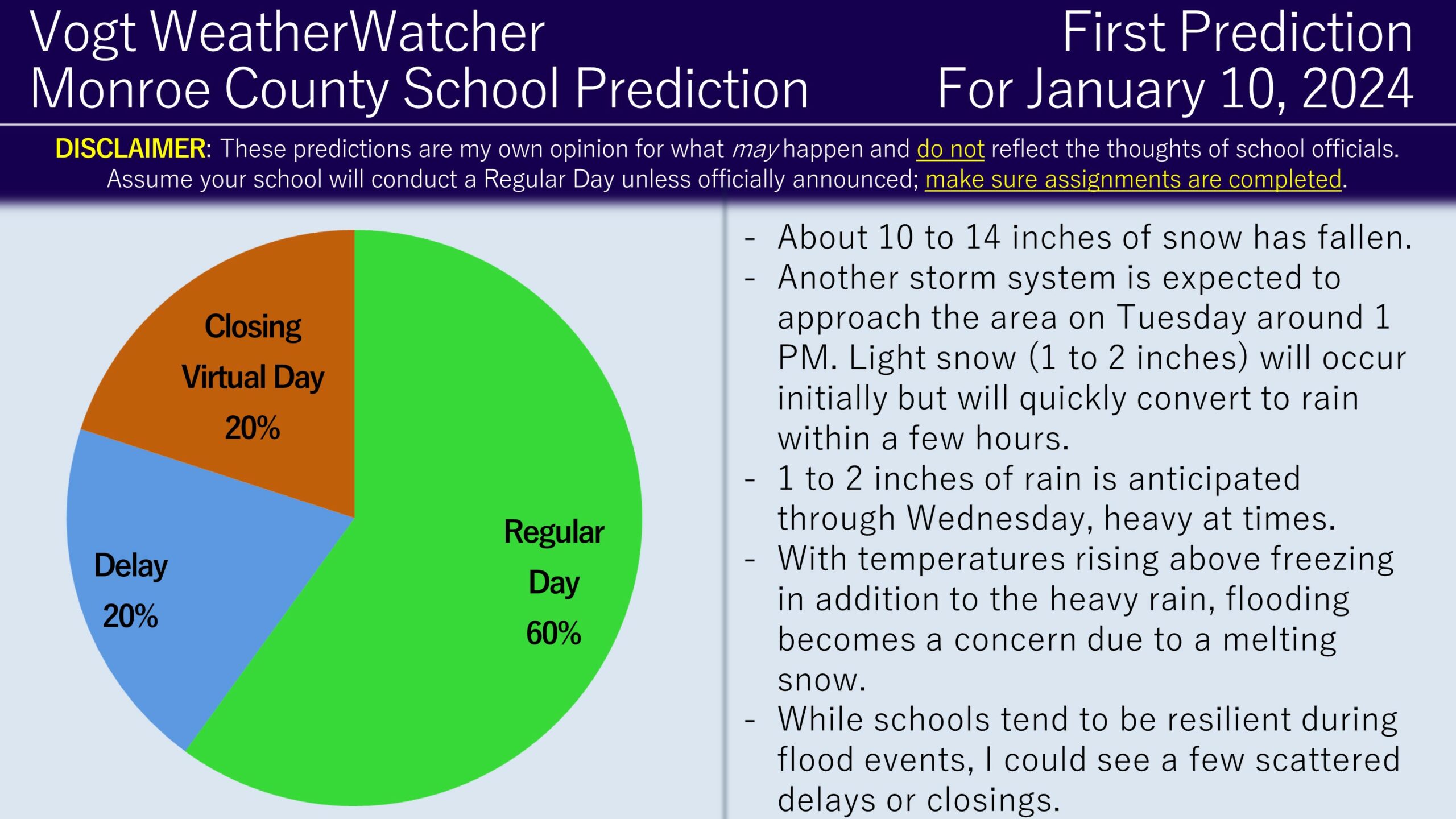
As the storm system move through the area, temperatures will be rising rapidly above freezing overnight and into Wednesday morning – reaching to 50s! Combine this with the existing snowpack and the additional rain (1 to 2 inches of rain), we start looking at a level of flooding enough to cause school reactions. Looking at the latest National Weather Service forecasts and model guidance, the flooding potential is high enough to where historically it could lead to isolated delays and closings; this likely wouldn’t impact every district, or perhaps most districts, but rather a few districts which have more exposure to streams or rivers. Ironically, this could be a situation where the valley districts actually have a higher risk to impacts than the elevated ones. As a result, I do favor the regular day scenario for Wednesday, but delay and closing risks are present.

I plan on issuing the next round of updates tomorrow morning. I do think it is possible for school districts to make announcements tonight for Monday morning. They could also re-evaluate in the morning, but keep in mind a re-evaluation does not mean a change to a closing; districts could easily stick with a delay decision. Be safe everyone, thank you for the support, and have a great rest of your weekend!