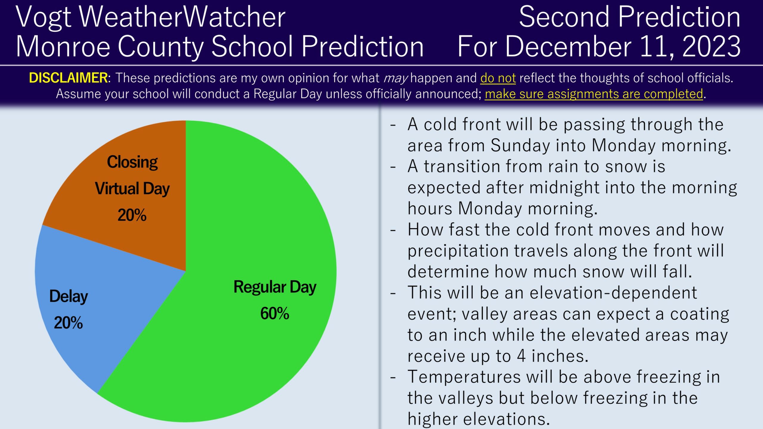
Good evening everyone and Happy Saturday! Hopefully your weekend is going well. Attached is the Second Prediction for Monday, December 11, 2023!
Based on the latest forecasts and model trends, there were some adjustments made to the prediction. The valley areas can still anticipate above freezing temperatures and around a coating of an inch of snowfall. However, I am noticing trends towards a 4 to 5 inch snowfall event for the higher elevations. Additionally, there is a chance temperatures may remain below freezing throughout the day for the highest elevations (1,750 to 2,000 feet). The timing of the snow is still from just after midnight until dawn (7 AM). Here is the latest forecast from the National Weather Service for Pennsylvania; you can see how elevation plays a role in snowfall expectations.
Considering these trends, I still think a Regular Day is the most likely scenario as most school districts within Monroe County are mostly populated in the lower-elevated areas and temperatures will be above freezing for these locations. For the higher-elevated areas, it becomes a murkier picture. There is an argument for conducting delays, but I am questioning how fast the roads will improve – if at all – with a 2 or 3 hour delay. I would not be surprised if we see elevated districts delay initial but with a handful ending up closing or going virtual.
