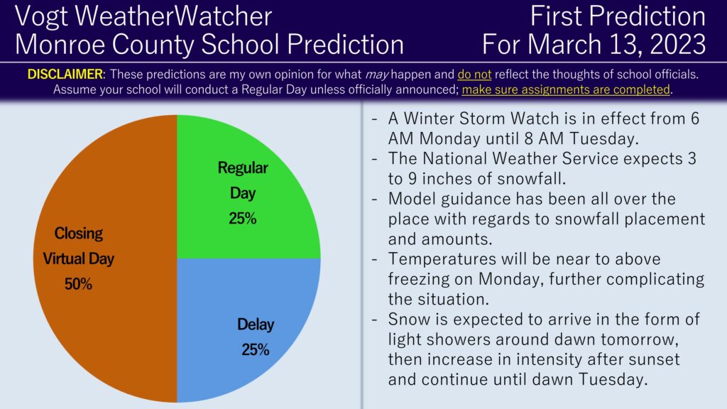
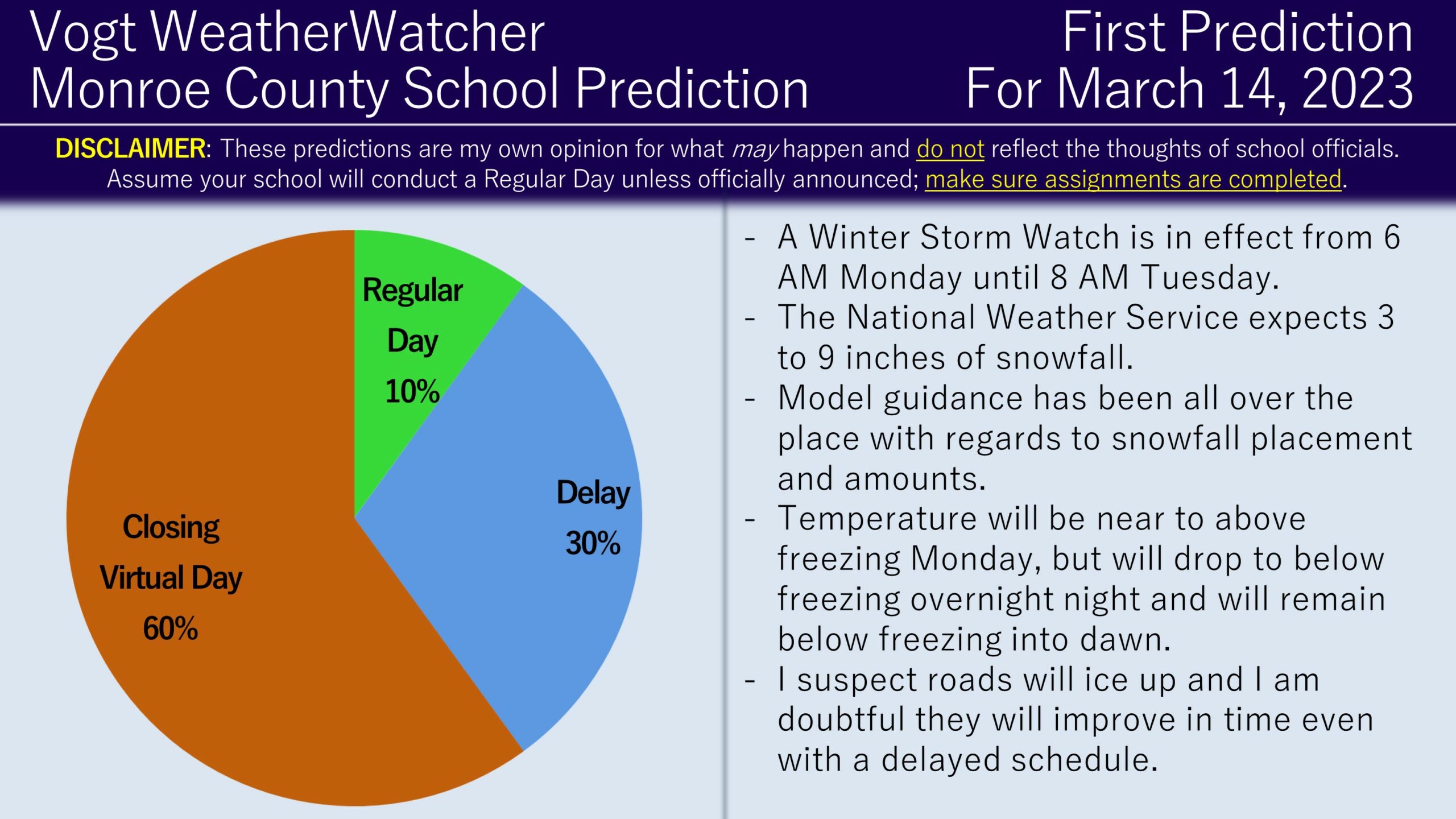
Good afternoon everyone! I hope you are enjoying the morning of Daylight Saving Time. We have snow coming down the pike tomorrow and Tuesday; therefore, attached is the First Predictions for March 13 and 14, 2023.
The theme for this winter has been complicated forecasts with above freezing temperatures throwing a wrench into everything, and the next two days will be no exception; in fact it may be the most complicated forecast of the winter! A Winter Storm Watch is in effect from 6 AM Monday until 8 AM Tuesday. The National Weather Service is anticipating between 3 to 9 inches of snowfall during that time. Model guidance has been incredibly inconsistent on how much our area will receive in snowfall, ranging from as little as a few inches of snowfall to as much as over a foot in the worst case scenario. Light snow is expected tomorrow around dawn, but temperatures will remain above freezing for most of the county. Snow is then expected to pickup in intensity overnight tomorrow night and especially into early Tuesday morning. As the snow picks up, temperatures will start to drop below freezing for most of the county. Snow is then expected to conclude in the morning hours Tuesday.
Part of the challenge is how much snow will actually occur and this will depend on where an inverted trough develops. An inverted trough is a line of precipitation that can form when a surface low pressure area starts merging with the upper-air low pressure; this line of precipitation in essence connects the two. Under the inverted trough is where additional snowfall accumulation can occur and signs currently point that Monroe County will be on the edge of it, which may allow higher-end snowfall totals to verify. Model guidance is still not in agreement on where this inverted trough will be, causing the snowfall forecast to have a wide range.
As you can see, there are many conflicting factors in play over the next few days. Focusing on Monday, given how schools have reacted so far this year, I do expect individual school outcomes (i.e. some close while some delay or even have a Regular Day). Therefore, I am going with 50% Closing (thinking of Pocono Mountain and East Stroudsburg specifically) and the remaining 50% split between Delays and Regular Days (Pleasant Valley and Stroudsburg comes to mind). As for Tuesday, I do think temperatures will drop enough to where it would impact all districts in the county and I do favor the Closing scenario for most districts.
Curious about getting hourly school predictions for your local county four days in advance? Check out the Premium Site! Want to get your hands on some merch? Swag available here! Interested in advertising your small business? Click here to inquire!


