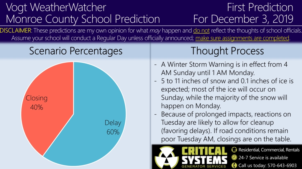
Good evening everyone. Attached is the First Prediction for Tuesday, December 3, 2019.
A Winter Storm Warning is in effect from 4 AM Sunday until 1 AM Tuesday. 5 to 11 inches of snow and a tenth of an inch of ice is expected during this time frame. Based on what I am seeing from model guidance, the core of the precipitation will occur in two phases. The first phase will be from late Sunday morning until Sunday evening; I am concerned ice accumulations will be closer to 0.25 inches due to prolonged freezing rain. If you are traveling, I recommend getting to your destination before noon tomorrow to be safe.
After a lull in the storm overnight Sunday night, snow is expected to pickup Monday morning and continue throughout the day; this is when the majority of snowfall is expected. I am concerned the area could receive the higher end of the snow forecast as model guidance is projecting our area to be under heavy snow bands. Because of the late stop time and the long-duration nature of this event, I suspect at least delays are on the table for Tuesday as schools need time to prepare/recover. With that said, if we receive higher than expected snowfall or if road conditions remain poor into Tuesday morning, closings are a valid possibility. I do favor the delay scenario for now (60%), but I am concerned for the higher-snowfall scenario (40% Closing).
I plan on issuing the Second Prediction for Tuesday tomorrow night. Avoid travel if possible on Sunday and Monday and prepare accordingly for this event. By the way, if you are looking for unique Christmas gifts, check out the check out the site’s merchandise and Premium site; this helps keep the service running. The Premium site is at a 20% discount from now until Tuesday 12/3 ($22.99 for the season). Your support is appreciated. 🙂
Stay safe everyone and have a great rest of your evening! #InVogtWeTrust

