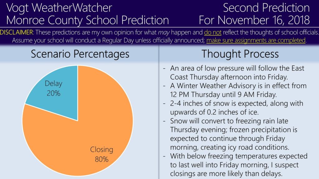
Good evening everyone. Attached are the Second Predictions for Thursday, November 15, and Friday, November 16, 2018.
The National Weather Service has issued a Winter Weather Advisory in effect from 12 PM Thursday until 9 AM Friday. 2 to 4 inches of snow and up to 0.2 inches of ice is expected during the advisory time period. Travel impacts are anticipated for the Thursday evening and Friday morning commutes — and their bus runs.
Since the average of models and forecasts suggest a 1 PM start time, I am keeping Thursday’s prediction odds the same. However, since snow and ice is expected to last all night into Friday morning and with the advisory remaining in effect until 9 AM, the odds for closings have risen (in my opinion). There may be a burst of heavy sleet or snow around dawn Friday morning, which would support the argument for closures. Regardless of the outcome, anticipate hazardous road conditions starting tomorrow afternoon lasting until Friday morning.
If you live, work, or commute through the Poconos, the Lehigh Valley, or the Scranton/Wilkes-Barre areas, I strongly recommend to check out the Premium site. The site features school closing probabilities, projected road impacts by time of day, and weather information for 12 counties across NE PA. The graphics highlight which areas are most prone to impacts due to winter weather. Membership is only $28.99 for the whole winter season. If you have not checked out the site, have a look! Free and sample graphics are available as well.
https://34.73.99.199index.php/premium/
My plan is to issue Thursday’s Final Prediction tomorrow morning and Friday’s Final Prediction tomorrow evening. Thank you for the support everyone — it is sincerely appreciated — have a good evening.


