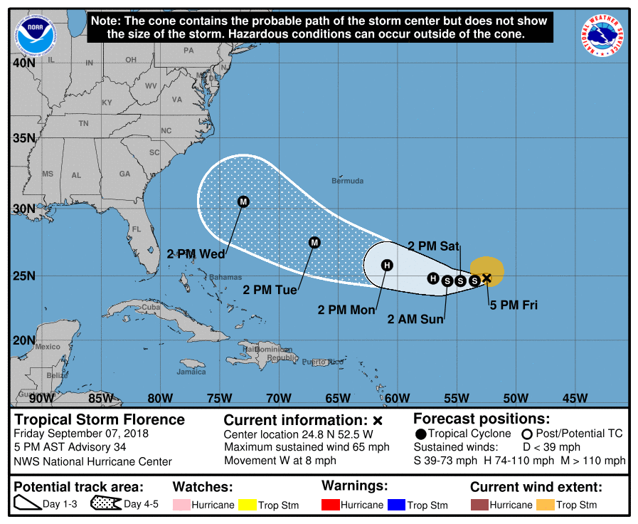
Over the last week, the meteorological community has been closely monitoring Tropical Storm Florence’s track in the Atlantic. Earlier in the week, it was expected for Florence to turn out to sea, but the odds of this occurring have been declining in recent days.
As of now, the most likely scenario (about a 70-80% chance) is a U.S. landfall. If a landfall does occur, potential landfall sites range from Northern Florida to the Mid-Atlantic. The timing would be 6 to 7 days from now. While model guidance has been very volatile in their run-to-run solutions, there has been a small trend southwards; in my opinion, the Carolinas have the highest risk for impacts from Florence.
You may have been seeing individual model outputs showing different possibilities, including Northeast impact scenarios. Be advised, individual model guidance has an average track error of over 200 miles for a Day 5 forecast. There is a lot of uncertainty regarding the future path of Florence; making decisions based on non-official data and could cause unnecessary worry.
At this stage, the only action I would recommend is to ensure you have a hurricane plan in place — you may not have to exercise it in a week’s time, but you have it for future events. I will be posting updates as confidence increases on Florence’s track. Have a good evening everyone and thank you for the support.

