Good evening everyone and Happy Friday – except to Mother Nature. I wanted to post a quick update regarding the winter weather expected this weekend.
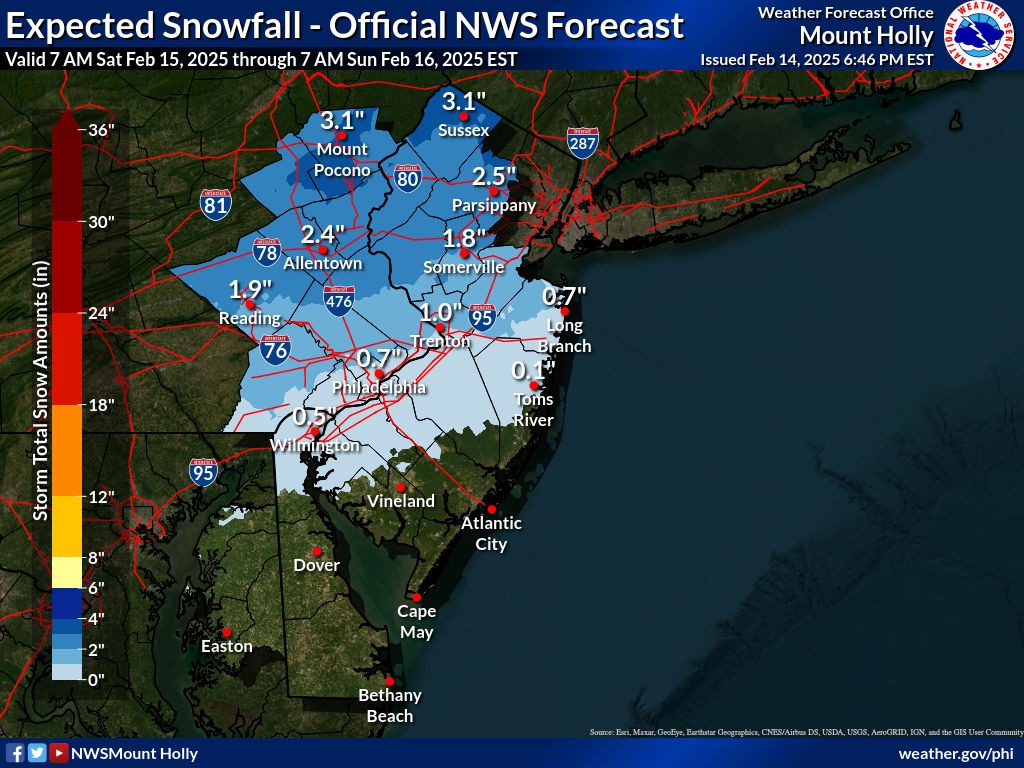
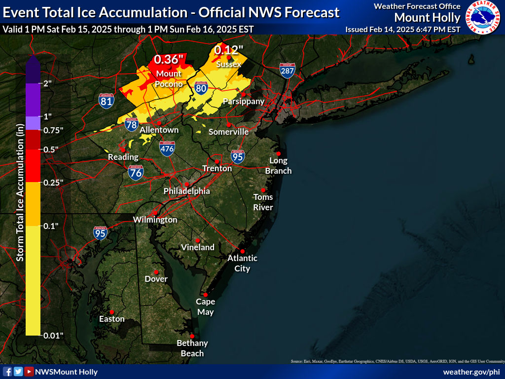
The National Weather Service has a Winter Weather Advisory in effect from noon tomorrow until 10 AM Sunday. The National Weather Service is anticipating 3 to 5 inches of snowfall and between 0.1 and 0.3 inches of ice. In other words, the amount of icy precipitation is expected to be double of what we had last go-around. Precipitation will convert to rain on Sunday, but then winds are expected to pick up, with gusts around 5 mph. It is not going to be a pleasant weekend, to say the least.
Considering Monday is Presidents’ Day, I am expecting the vast majority of school districts regionally to be closed considering it is a federal holiday, so I will not be doing a prediction for it. However, it is going to be interesting to see if there are any lingering impacts into Monday from a school perspective. I wouldn’t think so at face value (given temperatures will go above freezing on Sunday), but I could see a situation where black ice/a flash freeze could occur Sunday night when temperatures drop sharply.
I am keeping a close eye on next week as model guidance is becoming consistent on the idea of a Nor’easter developing. Early indications point to a jackpot zone right along I-95, with the Poconos getting some snow but not the jackpot. We will get better confidence and details as we get closer, but early inidications are pointing to an impactful event for the Northeast US.
Have a great rest of your evening, be safe, and thank you for the support!