Good afternoon everyone! Attached is the FINAL Prediction for Wednesday, February 14, 2024. We have quite of details to get into, so let’s jump right in.
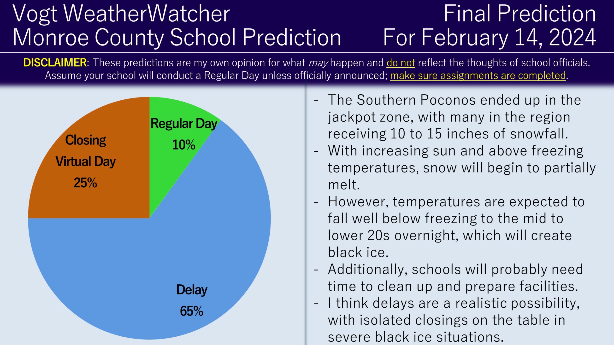
In a major suprise for the region, many locations in the Southern Poconos received 10 to 15 inches of snowall. This is drastically higher than what model guidance was suggesting at the 11th hour last night (5 inches at best). I have never seen model guidance flip-flop and fail so badly with snowfall projections in my life and create so much chaos within the meteorological community; the model performance was equivalent to 1990s standards. Whoever did their snow dance or prayer got it answered in a big way. I am hoping the meteorological community, either academically or operationally, researches this event to understand what went wrong and what could be done to prevent something like this from happening again.
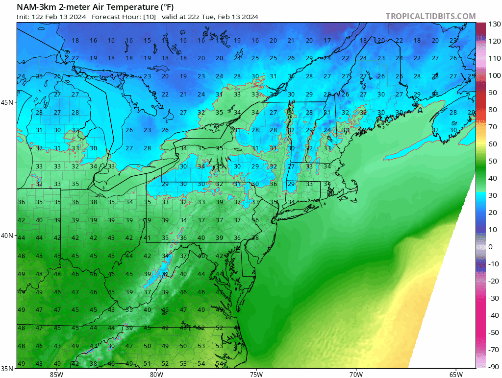
For now, we need to examine lingering impacts into Wednesday. Road conditions this morning were heavily snow covered as plows tried to keep up with one inch+ per hour snowfall rates. Temperatures are either around or above freezing in the area with increasing sun. However, as the evening progresses, temperatures will start to drop well below freezing into the mid to lower 20s. This will cause any slush and ponding to freeze up overnight.
Additionally, schools will likely need time tomorrow morning to clean up buildings and prepare buses for the morning runs. It is also historically common for schools to delay the following day of a major snow event. Therefore, I am favoring the delay scenario for most districts. Closings and virtual days are on the table if black ice is severe and widespread. I did keep a 10% chance for a regular day in case road cleanup ends up much faster than expected and if black ice is isolated in nature.
Keep an eye out for school announcements from now into tomorrow morning. Have a great rest of your day and thank you for the support!