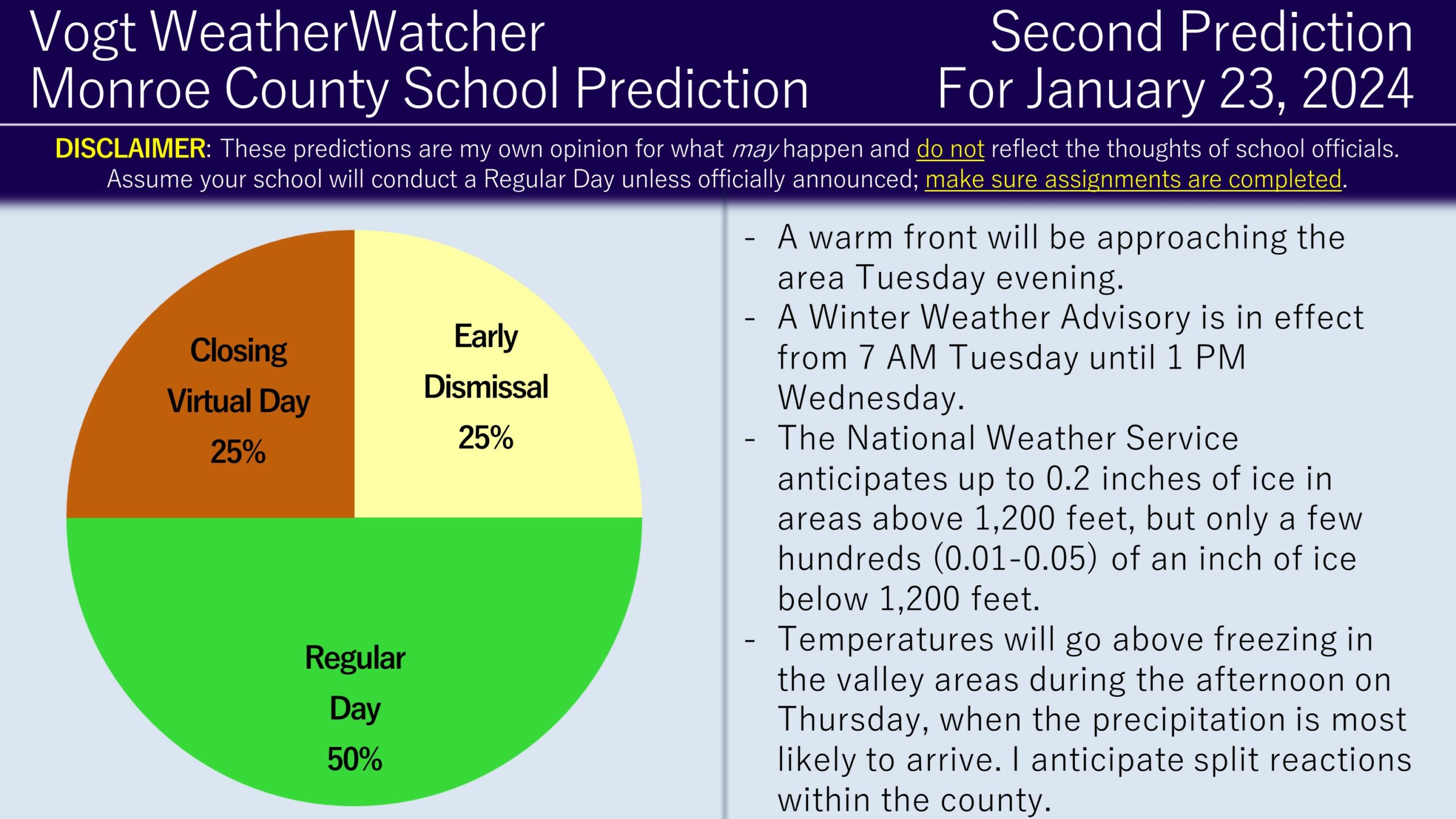
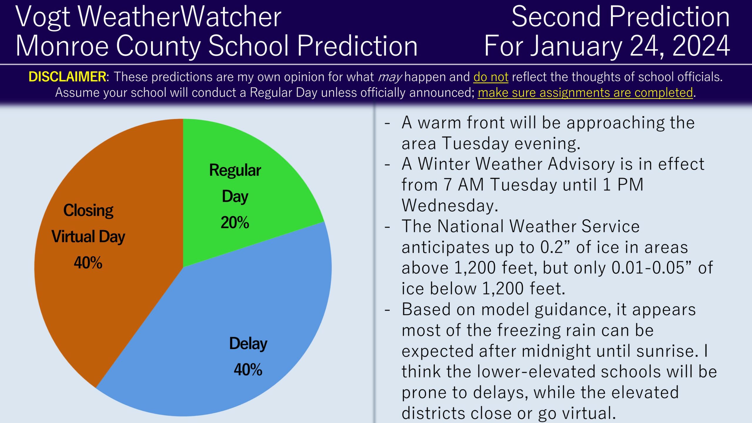
Good evening everyone and Happy Monday! Attached are the Second Predictions for Tuesday and Wednesday, January 24, 2024.
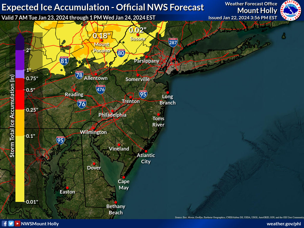
A Winter Weather Advisory is in effect from 7 AM Tuesday until 1 PM Wednesady. The National Weather Service is expecting 0.05 to 0.2 inches of ice for elevations above 1,200 feet, whereas locations under 1,200 feet could expected up to 0.05 inches of ice at most. Unfortuantely, confidence has not really improved versus yesterday. Valley locations may be below freezing Tuesday morning, but are expected to climb above freezing before noon and remain there until the evening hours. The elevated locations will likely remain at or below freezing during this entire event.

Based on all of the data I can get my hands on, I think realistically the precipitation will arrive after 10 AM on Tuesday then conclude around 2/3 PM. During this time I do think the valley locations will get above freezing, so I am think schools like Pleasant Valley and Stroudsburg may remain with a Regular Day. For Pocono Mountain, given their higher elevation exposure and a few reports I have gotten regarding chromebooks being sent home, I suspect they may go Virtual or Close tomorrow. East Stroudsburg, having a recent history of splitting the difference between these two sets of schools, I think will Early Dismiss tomorrow. Therefore, I have derived the Second Below in the porportionate ratios.

As for Wednesday, I do think this will be the best opportunity to get more widespread impacts as temperatures are anticipated to fall below freezing for all locations within the county. I also think overnight Tuesday night into Wednesday will be the window for the most ice accreation, particulary around the 3/4 AM timeframe. As a result, unless the forecast expectation changes, I think we will see a split reaction of Pocono Mountain and East Stroudsburg Close or go Virtual, while Pleasant Valley and Stroudsburg delay. I do think a Regular Day is still possible, so I have allocated a percentage towards this possibility. The mixed bag is the result of the varying elevations between the districts.
I plan on issuing the Final Prediction for Tuesday tomorrow morning (assuming all of the districts do not close) and the Final Prediction for Wednesday tomorrow evening. Keep your eyes out for alerts and have a great evening everyone. Thank you for the support!
Want to help out the service? Check out the Premium Site! It provides hourly school prediction updates up to four days in advance for 12 counties in NEPA, including the Scranton area, the Poconos, and the Lehigh Valley. It also includes weather forecasts, power outage risks, commute impacts, and long range outlooks. Membership lasts for a full year, which means any membership that starts now will continue into the beginning of the next winter. Check it out!
