Good evening everyone and Happy Monday! Yeah, I said Happy Monday. 🙂 Attached is the FINAL Prediction for Tuesday, January 9 and the Second Prediction for Wednesday, January 10.
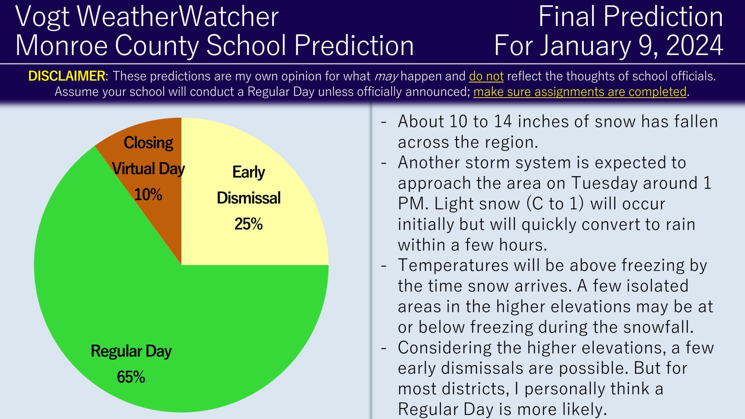
As discussed in yesterday’s post, another storm system is going to be approaching the area tomorrow. For most locations in the county, temperatures will be above freezing when the precipitation arrives around 1 PM, so I am anticipating Regular Days for most areas. However, school districts in the higher elevations will be exposed to below freezing temperatures and perhaps up to an inch of snowfall before changing to rain. I suspect these districts have a decent chance for early dismissals. As I type this, a few isolated elevated districts have announced virtual days or closings tomorrow, but I do not anticipate this to be the dominating outcome for the elevated areas.

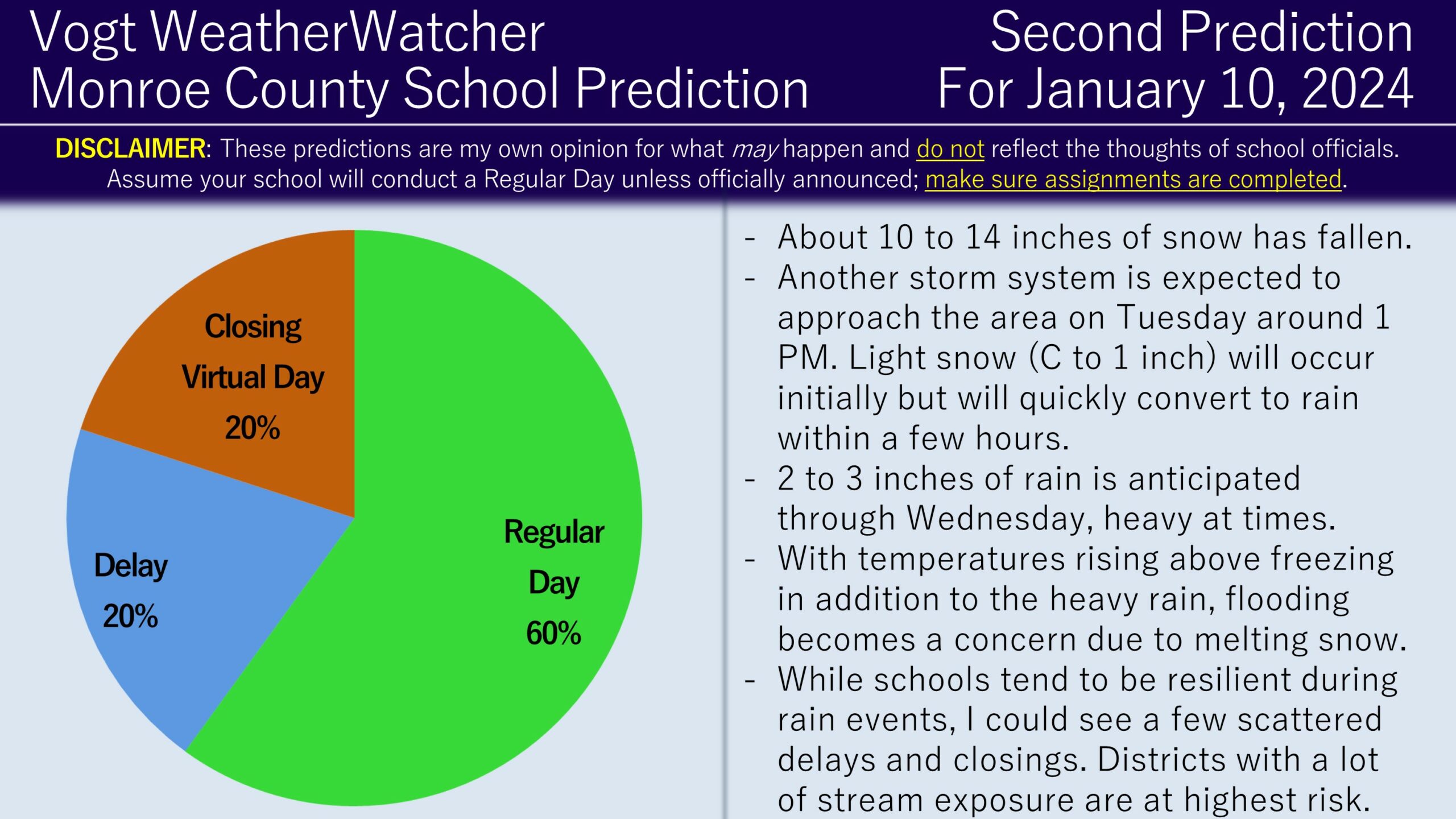
2 to 3 inches of rain with locally higher amounts is currently expected from Tuesday into Wednesday. While schools tend to be resilient against rain events, the big concern is going to be the rainfall, combined with temperatures in the 50s and a melting snowpack, will result in flooding throughout the region. Throw in gusty winds of up to 55 mph and we start introducing power outage risks. The challenge here is I do not know what the tolerance threshold will be for school districts in this situation, but based on what I can recall historical, scattered delays and cancellations appear likely, but I think more schools than not (barely) will go in on time.

I plan on issuing the Final Prediction for Wednesday tomorrow early evening. Keep an eye out for weather and school alerts throughout the day tomorrow. Do NOT drive through flooded roadways – it is nearly impossible to tell how deep it is until it is too late. Be safe and thank you for the support!