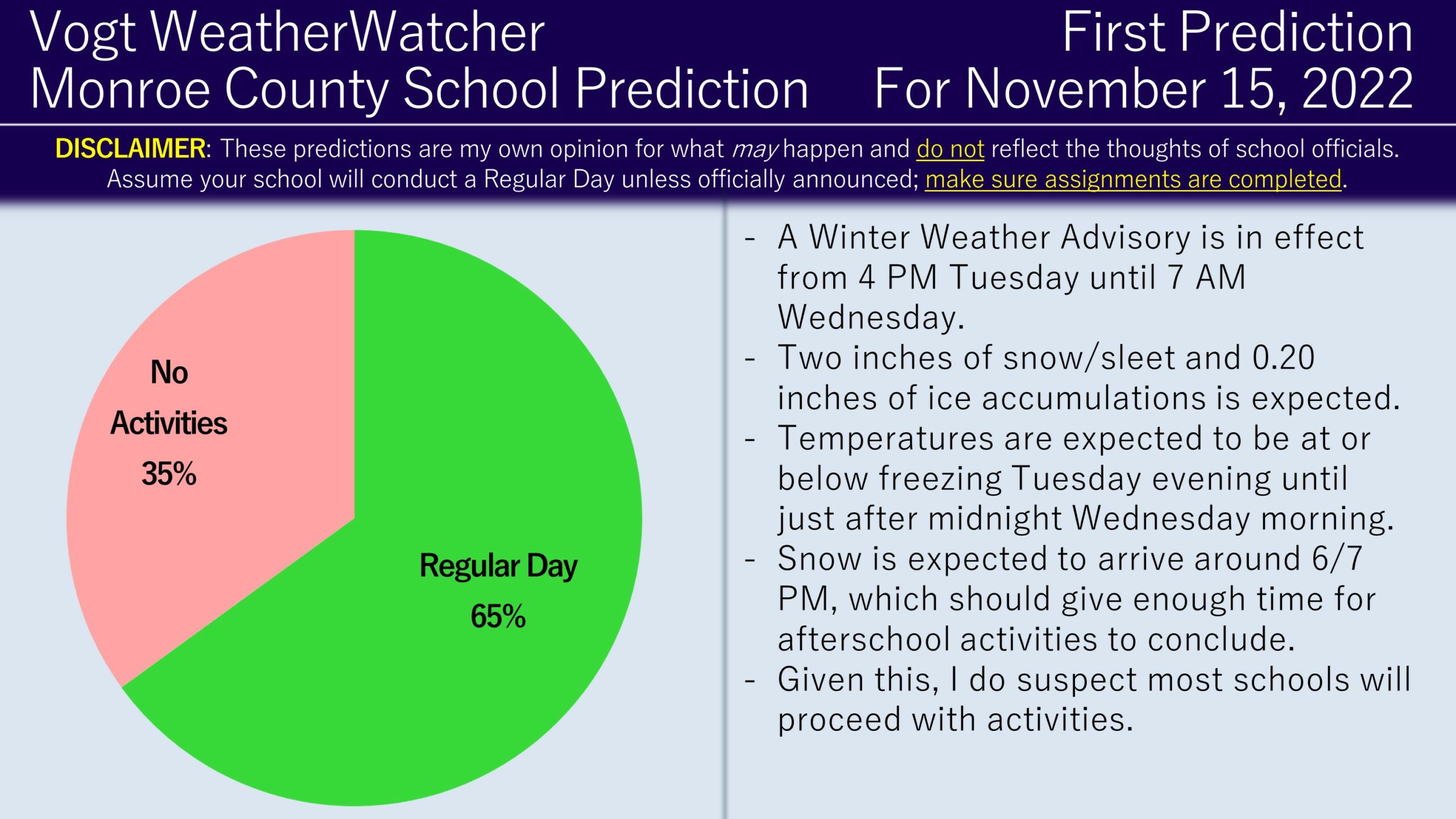
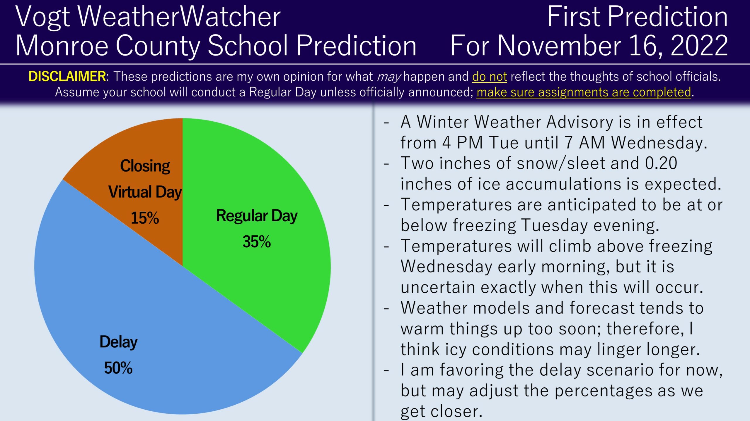
Good evening everyone! Happy Monday and it feels to good to be back in the saddle. Attached are the First Predictions for Tuesday November 15 and Wednesday November 16, 2022.
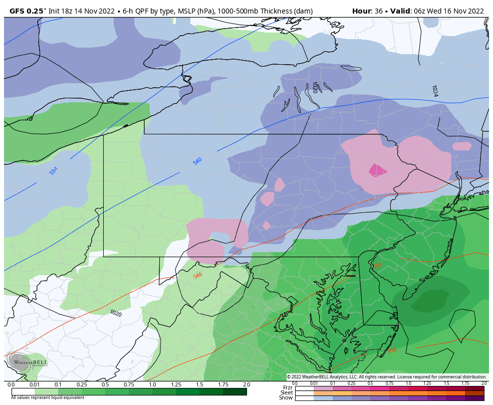
A Winter Weather Advisory is in effect from 4 PM Tuesday until 7 AM Wednesday; up to two inches of snow/sleet and 0.20 inches of ice accumulations is anticipated. Looking at model guidance, snow will realistically arrive around 6/7 PM tomorrow evening, then convert to sleet and freezing rain around 9 PM as temperatures rise. Temperatures will be below freezing initially but will gradually increase as the night progresses. Most locations are forecast to go above freezing and switch to rain after midnight; however, cold air has a tendency to stick around longer than expected. Considering these factors, I do favor a Regular Day for Tuesday as activities should conclude before the snow and a delay for Wednesday assuming temperatures do stay colder than model guidance suggests. I plan on doing the Final Prediction for Tuesday and the Second Prediction for Wednesday tomorrow morning.
Thanks everyone for the support as we are entering the 10th winter season of doing school predictions! I never thought this service would continue past my high school years, yet here we are today thanks to you!
Curious about getting school predictions for your local county hourly? Check out the Premium Site!
Want to get your hands on some merch? Swag available here!
Interested in advertising your small business? Click here to inquire!


