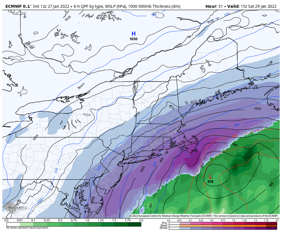
Good evening everyone! I hope your week has been going well. I would like to talk about this weekend’s snow as well as some updates coming to the website.
I have been keeping a close eye on trends for this weekend’s snow storm. Frankly, I am very skeptical we will see more than 3 inches out of it. The storm track is going to favor the coastal areas of NJ and New England, rather than areas northwest of I-95, including the Poconos. These types of systems are notorious for having a sharp cut-off between areas of no-snow and significant snow and we will be on that cut-off, perhaps on the no-snow side of it. I am going with a coating to 2 inches of snowfall; with a bust potential of 0″ and a boom potential of 5″. The timing of the main event will be late Friday night into Saturday late-morning. There may be some isolated snow showers tomorrow morning, but not significant enough to cause school impacts.
I do have some exciting news to share! I will be moving my website to a new server provider. This is a big deal because the server will allow me to scale-up resources as I need them; allowing the site to handle sudden traffic demands. The plan is to start the migration process Sunday night; during the migration, the site may have broken links and Premium Site graphics may not update. The goal is to have everything working by Monday night. I will post updates as the migration progresses and I appreciate everyone’s patience.
I will continue to watch this weekend’s system and will provide updates as warranted. Have a great day everyone and thank you for the support!

