Good evening everyone and Happy Wednesday! Attached is the FINAL Prediction for Thursday, January 20, and the Second Prediction for Friday, January 21, 2022.
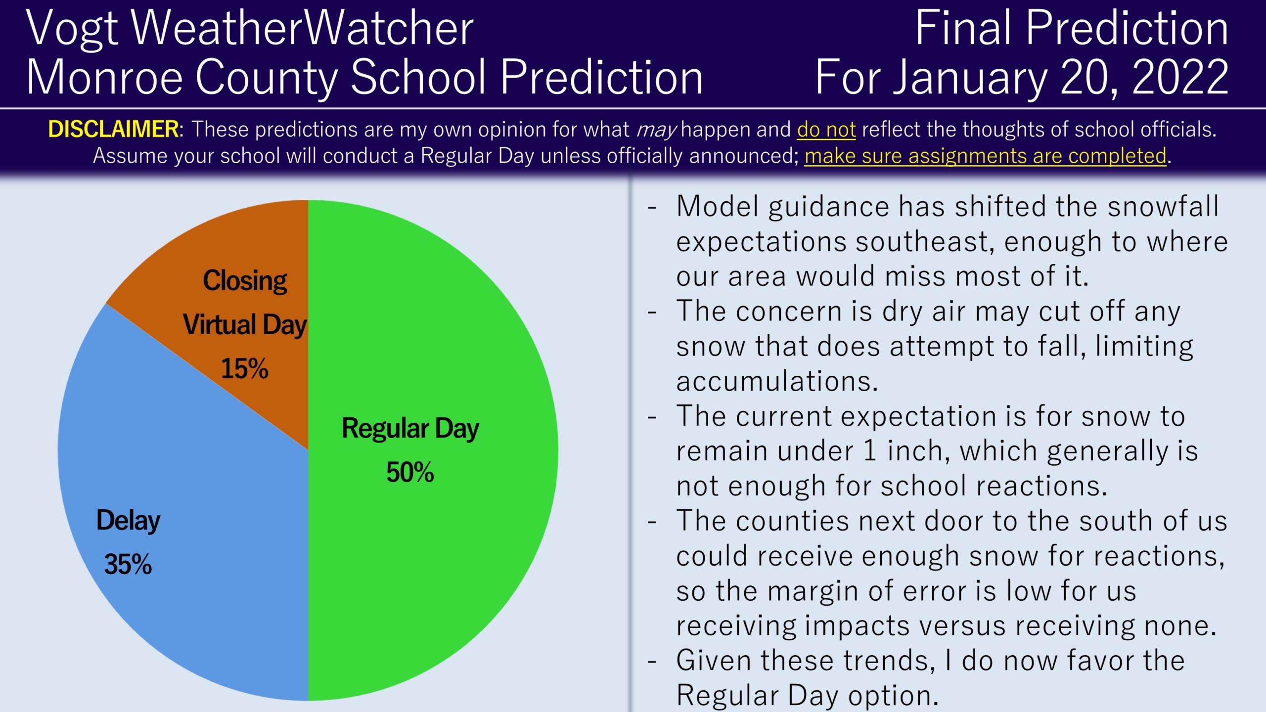
For Thursday, model guidance and forecasts have shifted southeast with snowfall expectations. This shift is cutting back snowfall amounts for our area to under one inch. This is due to the forecast of a sharp cut-off zone between those receiving 1 to 3 inches versus those receiving little to none and the trend (for snow lovers) is not favorable. The shift south also introduces more dry air, which may cause snow to evaporate before reaching the ground (virga). Given these trends, I now favor a Regular Day for our area. With that said, given the southern counties next door to us will be receiving 1 to 3 inches, the room for error is small – any shift back north, then we are game on for delays.
As for Friday, the forecast has not changed for the anticipation of cold wind chills, enough to where I think advisories will be issued. The threshold for Wind Chill Advisories is -15*F and it appears we may see cold wind chills as low as -20*F. Advisories are important because they are strong correlated with delays. While I still favor delays for our area on Friday, this hinges on advisories being issued. Since we are getting closer to Friday and no advisories have been issued, the Regular Day odds did increase.
The Final Prediction for Friday will come out tomorrow. Have a great day everyone and thank you for the support!


