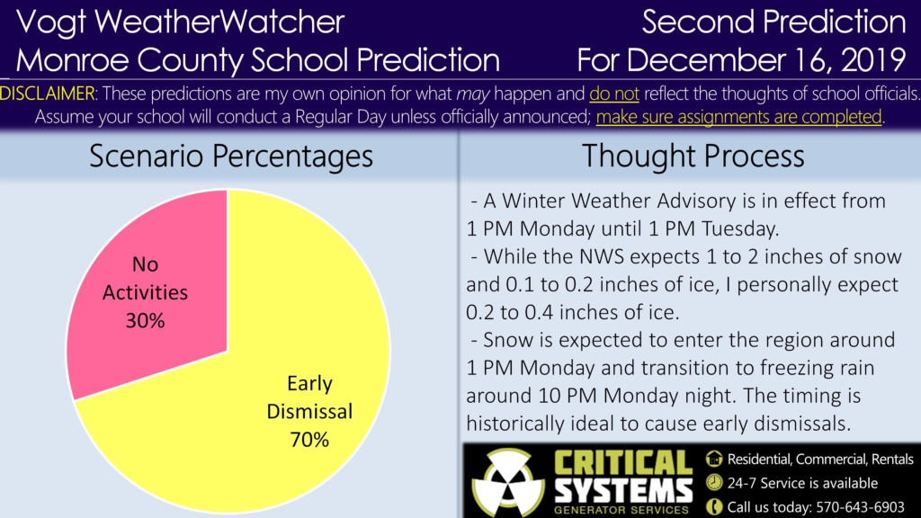
Good evening everyone! Attached is the Second Prediction for Monday, the Second Prediction for Tuesday, and the First Prediction for Wednesday. We have a lot of moving parts, so let’s get right to it!
A Winter Weather Advisory is in effect from 1 PM Monday until 1 PM Tuesday. The National Weather Service expects 1 to 2 inches of snow and 0.1 to 0.2 inches of ice during this time period. Snow will start at first, then convert to freezing rain Monday evening, lasting through Tuesday. Personally, I suspect our area will receive more freezing rain (0.2 to 0.4) given that this event has similarities to the last ice storm a couple of weeks ago.
With a 1 PM start time, this will have impacts on the afternoon bus runs, and I suspect school districts will likely early dismiss out of precaution. With that said, some model guidance has a delayed start time (not until late Monday evening). Since these factors cancel each other out, I am keeping the Early Dismissal odds at 70%.
The Closing odds for Tuesday have increased thanks to a longer icing event expected, lasting until 1 PM Tuesday. It is increasingly harder to find ways to squeeze in the school day with icing occurring during the morning bus runs.
With temperatures expected to drop below freezing (into the mid and lower 20s) Tuesday night, any remaining slush on roadways may freeze up overnight. Schools have historically delayed the following day after a significant snow or ice event, supporting the delay argument. This is not a slam dunk, though, if winds are able to dry the roads before they freeze.
The Final Prediction for Monday will be issued early tomorrow morning. The Final Prediction for Tuesday will be issued Monday evening. The Second Prediction for Wednesday will be issued tomorrow evening. Thanks everyone for your support and have a great evening!


