Good evening everyone! Attached are the First Predictions for Monday, December 16, and Tuesday, December 17, 2019.
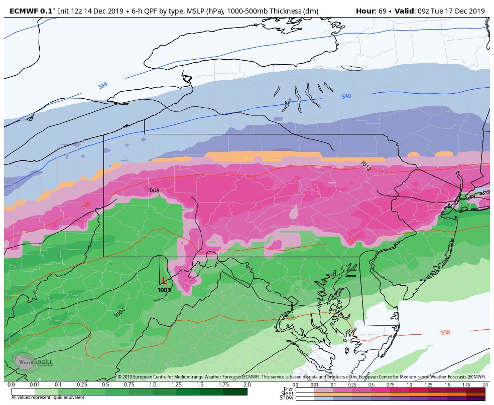
2 to 5 inches of snow and 0.25 to 0.5 inches of ice is anticipated from Monday afternoon through at least Tuesday morning. I will admit this forecast is aggressive compared to most outlets (NWS and EPAWA) as of this writing, but it is supported by NY NJ PA Weather who tends to do well with ice events. Snow will begin to enter the region around 1 PM Monday; historically, this is a strong argument for early dismissals, hence the favoritism towards the early out scenario.
The snow will convert to freezing rain around 10 PM Monday night and will continue through at least Tuesday morning. I have noticed model guidance is trending towards a longer duration ice event rather than lifting temperatures above freezing on Tuesday. Given this trend, I am strongly favoring the Closing scenario as I do not think roads would improve in time even if temperatures go above freezing Tuesday morning.
We have to monitor the potential for a flash freeze Tuesday night as temperatures fall strongly below freezing with slushy roads, which may cause delays Monday morning. This will strongly depend on how much snow and ice we actually receive on Monday/Tuesday and how strong the winds are (the lighter the winds, the higher chance for a flash freeze).
The Second Predictions for Monday and Tuesday will be issued tomorrow afternoon and a First Prediction for Wednesday will be issued on Monday. Have a good evening everyone and thank you for the support!
What to support the site? Check out the service’s Premium page and merchandise!


