Good morning everyone! I hope your workweek ended on a good note as we kickoff the weekend.
I have been monitoring the Sunday morning snow event, but all impacts are expected to remain south of the area. In fact, I think we will be lucky if we get an inch of snow — if anything at all.
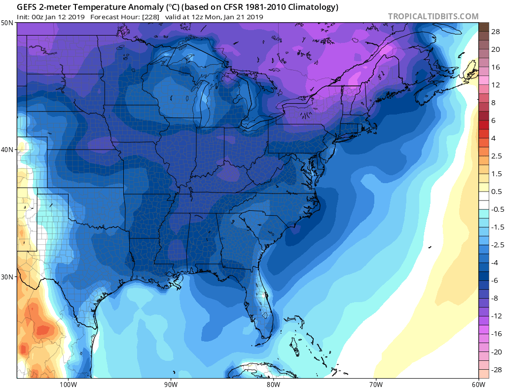
For those begging for winter, we may be getting a hefty response from Mother Nature. Multiple weather outlets are anticipating a pattern change around January 20th; some are drawing comparisons to the evolution of the 2014-15 winter, which was warm to start but became memorable in the end. After the 20th, we can anticipate much colder temperatures (highs in the 20s) and frequent snow events (1 to 2 a week). If you have a senior in high school and they were hoping to graduate early, the next 6 weeks may become their worse nightmare.
If you have not signed up for the Premium service, now is the perfect time to do so, especially as we shift into an active pattern. The site provides school predictions for 12 counties across Northeast PA, including Scranton, the Lehigh Valley, and all of the Poconos. It highlights which areas are most susceptible to school reactions during a winter event and indicates where road impacts will be the greatest. Check it out!
Premium Site: Premium Home Page
Freely Available Graphics: Sample Graphics, Observations
The image attached is the projected temperature difference below normal (in Celsius) around 20th, showing the expanse of the upcoming colder pattern. Pattern changes are usually accompanied by storm systems, so we have to watch this time period carefully. Have a great weekend everyone and thank you for the support!

