Good evening everyone! I hope your week is going well as we are approaching another weekend.
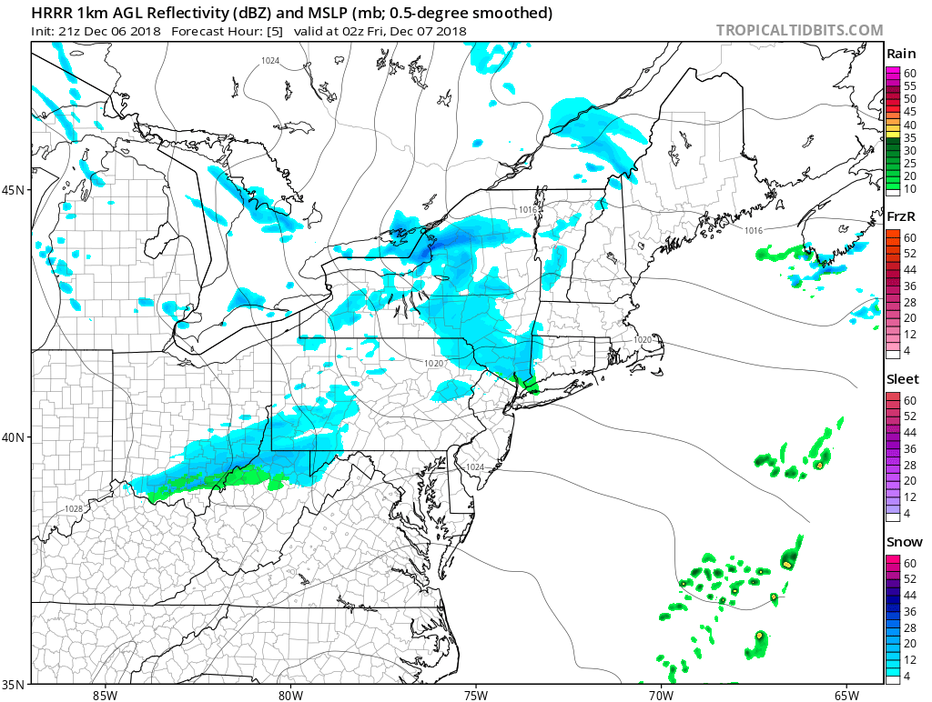
A cold front is expected to pass through the region overnight tonight. This will result in colder temperatures by tomorrow morning and even a few snow showers before dawn. While the front has plenty of snow with it now, it is expected to weaken as it approaches our area, limiting accumulations to under an inch. In my opinion, I do not see school delays resulting from these showers.
As far as the longer range, temperatures are expected to moderate as we get towards Mid-December. While it is not impossible to see snow during warmer periods, us snow-lovers should manage our expectations. I think our realistic best chance for major snows will be towards the end of the month. If you are worried about the winter being a bust, keep in mind the winters of 2013-14 and 2014-15 both had warm Decembers; plus, there is a correlation between cold Novembers (which we had one this year) and cold/stormy winters. Be patient!
If you are trying to find Christmas gifts and if you want to help out the service, there are a few options available this season! Back by popular demand, there are hoodies, coffee mugs, and shirts available for sale now and through the winter; or, if you are interested in local school predictions, weather forecasts, and road impacts for multiple counties across Northeastern PA, a membership to the Premium site will be worthwhile!
Premium Site: https://34.73.99.199index.php/premium/
Merchandise: https://teespring.com/vogt-weatherwatcher-merch#pid=212&cid=5820&sid=front
That is all I have for now; thank you everyone for the support so far this winter, it is appreciated. Have a great rest of your evening!

