And so it begins…
Good evening everyone. Below are the First Predictions for Thursday, November 15, and Friday, November 16, 2018.
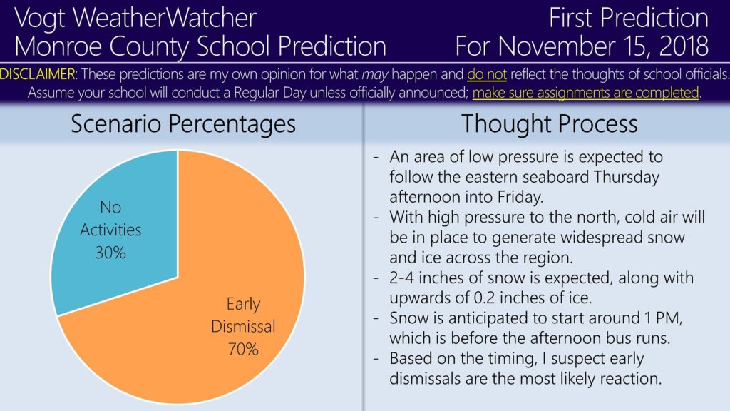
An area of low pressure is expected to track along the east coast Thursday afternoon into Friday morning. With cold air in place, widespread snow and ice accumulations are forecasted during this time period. 2-4 inches of snow and upwards of 0.2 inches of ice is anticipated for the area.
As for school impacts, because the snow will likely arrive around 1 PM Thursday, which is before the afternoon bus runs, I suspect school districts may early dismiss to get ahead of the snow. Because below freezing temperatures will likely remain through Friday morning, I expect most, if not all, precipitation to remain frozen, whether it be snow or freezing rain; this will likely to cause hazardous road conditions which would impact the morning bus runs on Friday. In my opinion, I think these impacts will be large enough to cause closures.
If you have not checked out the Premium site, now is a perfect time to do so! By subscribing, you get to see school predictions, road impacts, and forecasts for 12 counties across NE PA. The site is generating graphics for the Thursday/Friday event; take a look!
https://34.73.99.199index.php/premium/
My plan is to issue the Second Predictions for both Thursday and Friday tomorrow evening, Thursday’s Final Prediction Thursday morning, and Friday’s Final Prediction Thursday evening. Thank you all for the support, it is appreciated; have a great rest of your evening.


