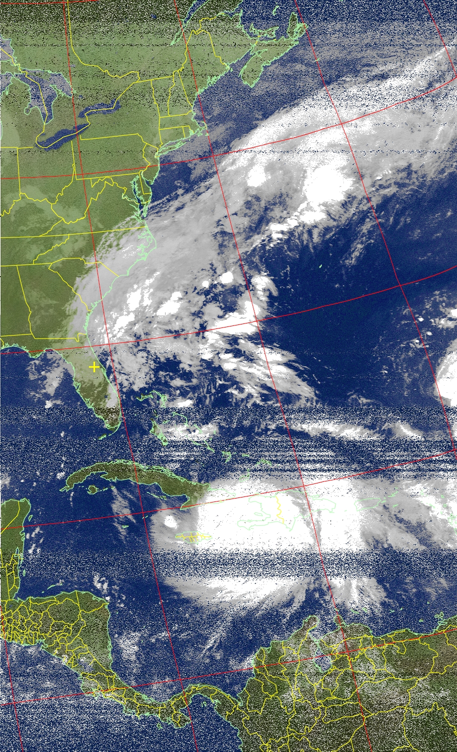
Good morning everyone; I hope your week is off to a good start. As you may have heard in the news, Hurricane Matthew is making its way north from the Caribbean into the Bahamas while causing catastrophic damage to Haiti. In this post, I will explain the impacts which could occur from Matthew both near-term and long-term.
The Forecast — As of the 5 AM advisory, the National Hurricane Center (NHC) is expecting Matthew to continue north between Haiti and Cuba then make a northwest turn towards the coast of Florida, causing significant disruptions to the Bahamas. As Matthew approaches Florida, it is anticipated to turn north just before reaching land and is expected to parallel the Southeast coast as it heads out to sea. See the NHC forecast graphic below; Hurricane Watches are expected to be issued soon for the Floridian East Coast.
Uncertainty in the Forecast — The forecast cone above represents where the center of Matthew could be over the next five days; it does not represent the wind field. In other words, at 2 AM on Friday, the center could be over Central Florida or further out to sea based on historical forecast error. To better visualize this, below is an output from the GEFS computer model (the GEFS is a collection of mini-computers that each produce different outputs based on slightly different conditions; it is used to account possible errors and derive a forecast mean). This image is of mean sea-level pressure for Friday Morning. Notice how most of the outputs have the center of Matthew just off the coast of Florida while others are further inland or further away.
Short-Term Impacts — Over the next few days, impacts are not expected in the Northeast due to Matthew being located well to the south. However, for those who are not aware, I have been living in Central Florida for almost two years. I have been operating this service as if I still live in Pennsylvania. There is a strong possibility that I may experience impacts from Matthew, likely in the form of 30-60 mph winds. I do not know what the likelihood of losing power or internet is; but in the evident you do not see me active from Friday on, I am likely disconnected from the world. I will post updates on my condition.
Long-Term Impacts — As of now, the NHC is expecting the storm to head out to sea once it impacts the Southeast. However, some models are producing solutions of Matthew continuing up the Mid-Atlantic coast. We still need to wait and see what exact path it will take in 4 to 7 days. If Matthew heads up the East Coast, the primary threat to Northeast PA would be excessive rainfall (4″+) in a short period of time. But again, we still need to figure out its future track. Below is the GEFS model of possible tracks Matthew could take over the course of its life. Notice how the spread of outputs drastically increases past the Carolinas — this best visualizes the uncertainty in the future track.
I will continue to provide updates on a regular basis as best as I can, given I do not lose power or internet. Continue to monitor the forecast and have a good Tuesday everyone.


